“First Lancair Flight”
February 25, 2007“Lancair/Cirrus Comparison”
February 27, 2007OK so I finished my work for PFC (Sacramento), getting the X-Plane 8.60 FAA-approved version of X-Plane tweaked just right for them, and then it was time to head off to Kansas City to meet with my customer-service guy (Randy Witt) to make plans for X-Plane 9. (HUH!?!?)
Look at a map and draw an arc from Sacramento to Kansas City.. it’s 1426 miles… about 2/3 of the way across the Country.
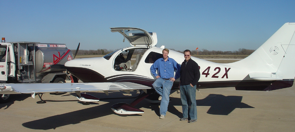
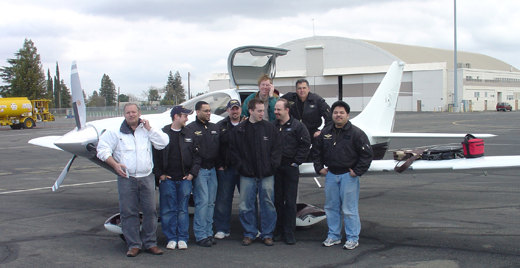
My Cirrus could never make that flight non-stop… could the Columbia-400? Below, a quick picture with part of the PFC-team at Sacramento.
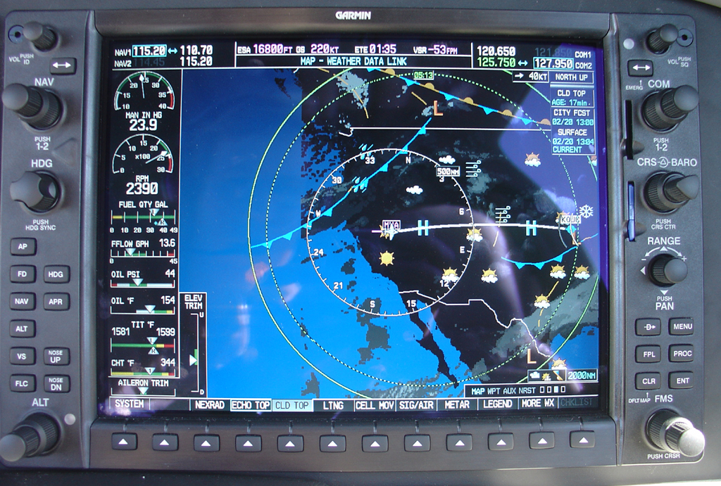
A quick take-off with full tanks of gas (106 gallons) and the Garmin-1000 MFD has this to tell me: (It looks like nice weather for the trip, if you don’t mind going over a little snow and clouds about halfway there! The ETE of 1:35 means one minute and 35 seconds to MVA VOR, a checkpoint that ATC gave me to fly enroute. The blue lines with flags are cold-fronts moving in behind me, the gray whispy things are clouds in the South-East, and the solid green circle is my absolute range: Most of North America.
And this outside:
Once established at 17,000 feet, IFR, on autopilot, I took a picture of the over-all cockpit layout for you: (Notice the hand-held GPS sitting on the throttle quadrant. That is an isolated fall-back if the total navigation system in the airplane goes belly-up)… difficult with 2 GPS’s, 2 electrical buses, 2 batteries, and 2 generators.
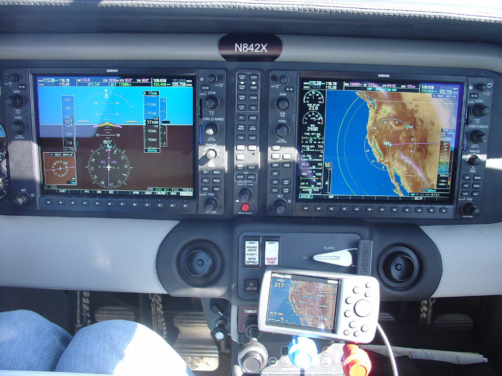
The flight, at 1426 miles, would be long, but at 250 miles per hour (220 knots), would only be about 5.6 hours… well inside the endurance envelope of an airplane that carries 106 gallons and burns 13.6 gallons per hour when running at reduced power. Looking on the lower-left of the right-hand screen above, you can see that wee are running at 24″ of manifold pressure, 2400 rpm, burning 13.6 gallons per hour. The oil pressure is nominal, the oil temperature is quite low, the turbine inlet temperature (the temperature of the air AFTER combustion, but right BEFORE entering the turbocharger turbines) is very close to maximum temperature, at about 1,600 degrees F! One can hardly imagine the temperature and pressure of the air in this place: Well over a THOUSAND degrees from burning fuel, crammed at high pressure tight into a turbine spinning at about ONE-HUNDRED THOUSAND RPM. Lancair Columbia 400’s seem to run pretty hot in the turbine-inlet when run lean-of-peak! The Cylinder head temperature, at bottom, is right in the middle of the green. You may notice that I have more fuel in the left tank than the right.. OOPS! The ADVISORY button on the lower-right of the left-hand display is flashing, telling me about the fuel imbalance. Time to fix that!
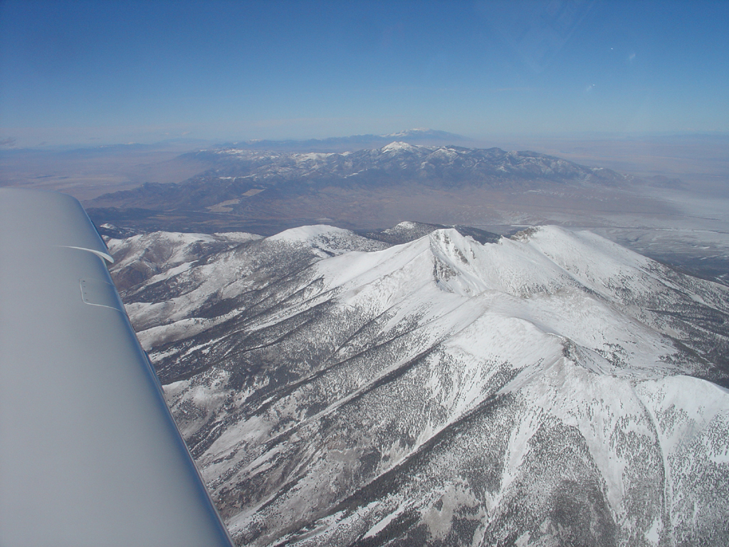
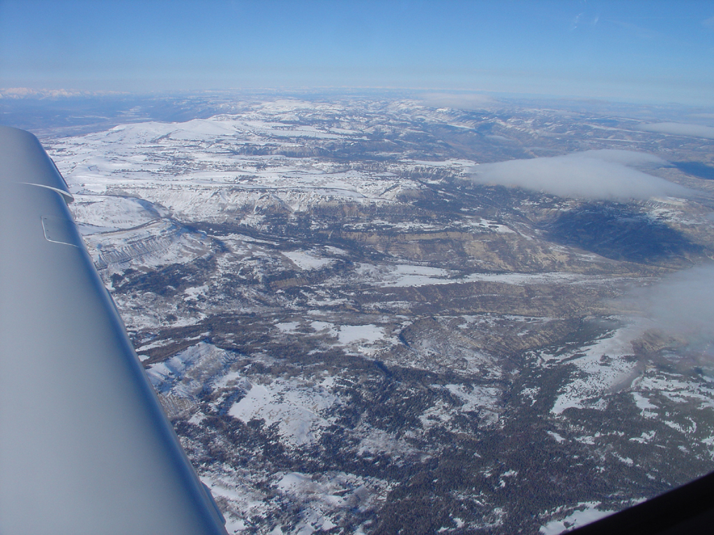
After about the first hour of the flight, being heads-down in the cockpit trying to finish familiarizing myself with all that there is to set up for maximum safety and awareness, it is time to look up and look around a bit! What’s out the window? Would you want to crash there?
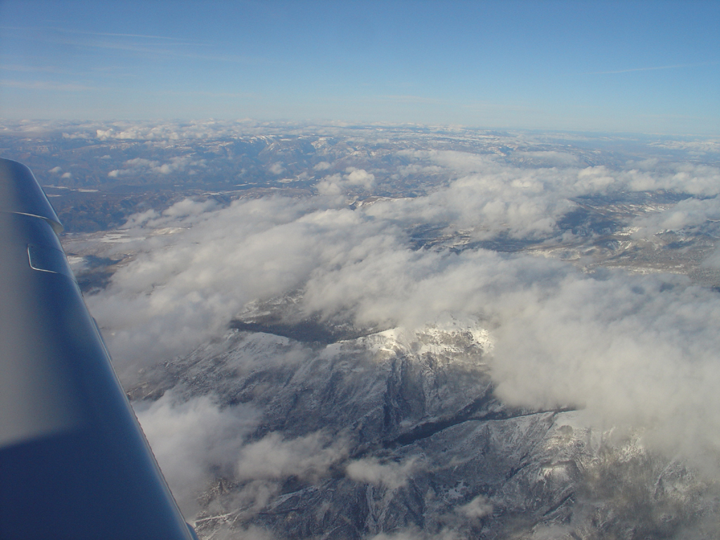
Now here is something cool: Over the Rocky mountains, I noticed my airspeed beginning to bleed off! The nose of the plane was rising just to hold altitude as the airspeed bled away! The autopilot was clearly raising the nose as it needed to to hold altitude as the power of the engine evaporated! But why? The RPM was fine! The manifold pressure was fine! Had the turbochargers finally succumbed to the insane heat and pressure and begun to fuse into a blob of red-hot molten metal? What was wrong? The plane was clearly struggling, down to 120 knots indicated airspeed, working as if it was climbing. As I pondered what to do next, the plane suddenly did a little ‘bobbity-boop’ dance in turbulence for about 2 seconds and then the autopilot gradually began LOWERING the nose (the aircraft never budging from 17,000 feet!) as the speed began to climb! Soon the airplane was clearly SURFING A WAVE, riding along, nose-down, speed surging to 180 knots indicated without ever budging from it’s assigned altitude of 17,000 feet! Now it was clear what was going on: I WAS RIDING A MOUNTAIN WAVE! Air was clearly undulating up and down over many miles downstream from the tall Rockies, and in the downdraft, the Lancair growled and clawed against the descending air, holding it’s own against the descending air but only by sacrificing speed. But remember: A sinusoidal wave must go UP for every bit it goes DOWN, and after a little turbulence at the inflection point, I got to ride the wave to my advantage, surfing the updrafts to gain extra speed! And so it went for maybe 20 minutes over the Rockies, the nose slowly going up and down like a boat in slow motion as the plane doggedly held it’s altitude at the cost of an ebb and flow in speed.
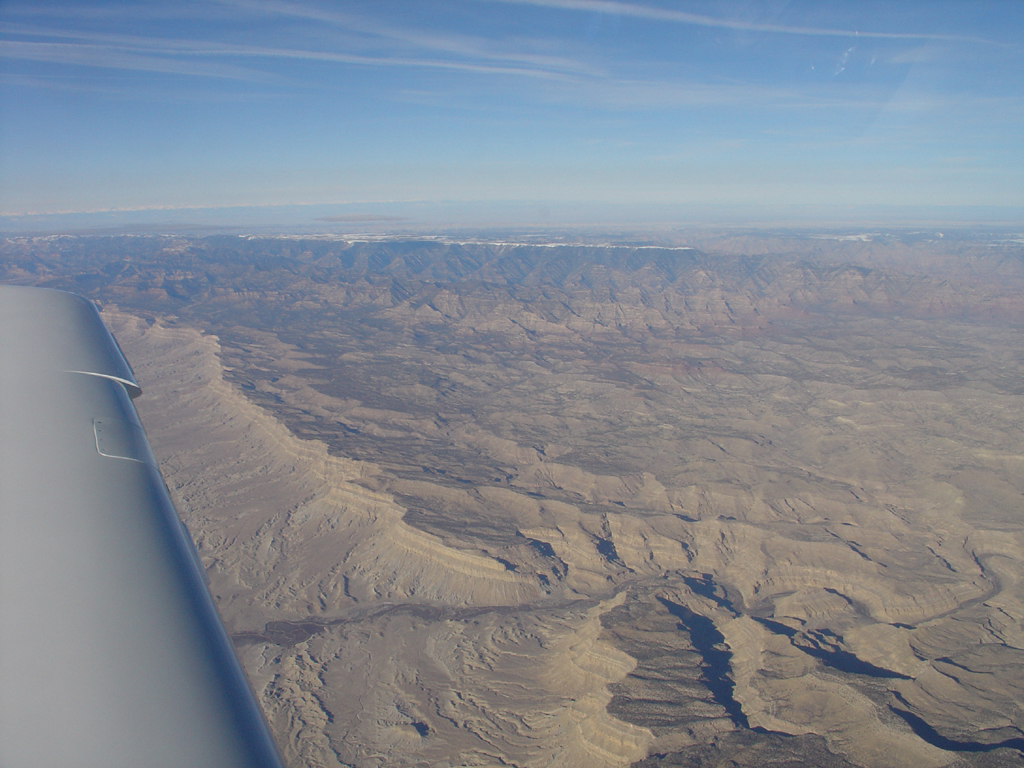
And, after hours over the Western Rockies, we move into some area of Mars, it looks like…
After about 3 or 4 hours, the sun was setting, and here, sadly, is where my digital camera totally loses it’s ability to capture the moment. Flying East in a speedy bird, the sunsets are brief and not seen, as you are racing AWAY from the sun, losing one timezone every 3 hours or so… that’s leaving the sun behind 33% faster than sitting still on Earth, so the sunsets are 33% shorter when flying East in a Lancair than they are when motionless. Conversely, of course, you get a 33% LONGER sunset to watch when heading west. Anyway, a quick and dim sunset occurred, made dark and smoky by the sun-glassed rear-windows of the Lancair, and then the mountains passed away, leaving the bleak, snowy planes of the Midwest. At that time after sunset on a cloudy winter day in the Midwest, the snow is all bleak and frigid white, and the white wings of the Lancair were a perfect bleak gray camouflage against the snow.. everything frigid and barren white surrounding the little lit-up cockpit and red-hot turbo. (The turbo does glow red hot, though you cannot SEE it in a Lancair).
As day became night, Kansas City was still 2 hours or so out. With techno running on the XM radio to keep me awake, and continuous re-checks of the fuel (by comparing the fuel required to complete the trip to the fuel on board) the weather at many places along the route (by moving a little mouse-cursor over each airport and selecting it on the G1000, and then hitting the “WXR” button to see the weather at that particular airport) the airways (by checking for other aircraft on the moving map) the airplane (by checking the fuel, oil, cylinder, exhaust gas, and cylinder temperatures, pressures, and flows) and myself (by checking the oxygen system level, oxygen outlet pressure level, oxygen meter green-light, and blood-O2 saturation with a portable checker) I really did not have time, over the course of the 6-hour trip, to do much other than document this flight with a few photos! Of course, you do not NEED to continuously re-check the status of the airplane, airways, weather, fuel, and yourself, but when you are by yourself with 1 engine at 17,000 feet over the frigid snow and mountains at night, you sort of have a tendency to.
So, 6 hours into the flight, 2 hours into the night, I arrive at KOJC within about 10 minutes of the time and a few gallons of the fuel predicted at the beginning of the flight… just in time for Randy and me and some friends to make it to our favorite Thai restaurant for dinner. They told me at dinner that I even SMELLED like my airplane, so I let them smell me!